Network management of the shallow ground water table depending on rain falland the seepage from conveyance network of land reclamation consortiums
The shallow groundwater table of Emilia-Romagna plain is a resource whose contribution either positive (water supply of crops), or negative (salt wedge) has still not been clearlydelineated. This Plan proposes to determine her influence on crops, in particular in the strip in which it is fed by seepage from the network consortium channels, and to make an estimation of the environmental and economic benefits. In addition, it intends to make economically sustainable the regional monitoring network of freatic water table.
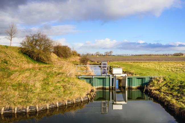
The Plan consists of four actions, the first of which concerns the validation of empirical algorithm ARPAE - ISCM for prediction of shallow groundwater table level and their subsequent deployment in the software FaldaNet. The second action is a 2 sites monitoring, in addition to other 4 ones belongings to a previous Plan, with a purpose to study relations between irrigation canals and shallow groundwater table. The third action will seek to determine the water contribution of shallow groundwater table in respect of selected crops.
The fourth, finally, will produce an assessment of the economic and environmental benefit related to seepage from the regional conveyance network managed by the consortium.
The first purpose (action 1), is to replace most of the manual readings in the 135 stations of the regional monitoring network of shallow groundwater table, with reliable algorithm produced by ARPAE-ISCM. This will enable the staff of the Consortia of Reclamation to continue the manual readings for the remaining stations, with a full sustainability of the system for the future. The data of shallow groundwater table level derived from algorithms will then be used in the on-line software Irrinet to provide the irrigation advice.
The second significant result is related to action 2 and consists of a new GIS layer that will describe more accurately the state of shallow groundwater table on the plain of Emilia Romagna. This layer will be used to elaborate maps of water table in the application FaldaNet, and so used in Irrinet.
The last result is derived from the products in actions 2, 3 and 4 and consists in the evaluation of the benefit for water seepage by channels in the shallow groundwater table. It will apply to both components, environmental and economic, in a vision effective throughout the territory of the regional plain. The final document is the basis for the rational use planning of this resource for the benefit of selected crops.
| Titolo/Descrizione | Url | Tipologia |
|---|---|---|
|
Sito web del progetto
|
Sito web
|
|
|
Relazione tecnica finale
|
Materiali utili
|